Where the weather is: Destin — Hurricane Warning · Pensacola — Storm Surge Warning · Atlanta — High Wind Warning · San Diego — Tropical Storm Watch · Washington — rain median 1.1 in · Arlington — rain median 1.1 inWhere the weather is: Destin — Hurricane Warning · Pensacola — Storm Surge Warning · Atlanta — High Wind Warning · San Diego — Tropical Storm Watch · Washington — rain median 1.1 in · Arlington — rain median 1.1 inWhere the weather is: Destin — Hurricane Warning · Pensacola — Storm Surge Warning · Atlanta — High Wind Warning · San Diego — Tropical Storm Watch · Washington — rain median 1.1 in · Arlington — rain median 1.1 inWhere the weather is: Destin — Hurricane Warning · Pensacola — Storm Surge Warning · Atlanta — High Wind Warning · San Diego — Tropical Storm Watch · Washington — rain median 1.1 in · Arlington — rain median 1.1 inWhere the weather is: Destin — Hurricane Warning · Pensacola — Storm Surge Warning · Atlanta — High Wind Warning · San Diego — Tropical Storm Watch · Washington — rain median 1.1 in · Arlington — rain median 1.1 inWhere the weather is: Destin — Hurricane Warning · Pensacola — Storm Surge Warning · Atlanta — High Wind Warning · San Diego — Tropical Storm Watch · Washington — rain median 1.1 in · Arlington — rain median 1.1 in
Hurricane Isaias, now 110 mph and moving north-northeast at 15 mph, is set to come ashore this evening on the Alabama or Florida Panhandle coast, and Birmingham's Tropical Storm Watch and Flood Watch stand. The storm's wind field is expected to grow as it interacts with a trough, so damaging gusts reach well inland, not just at the coast.
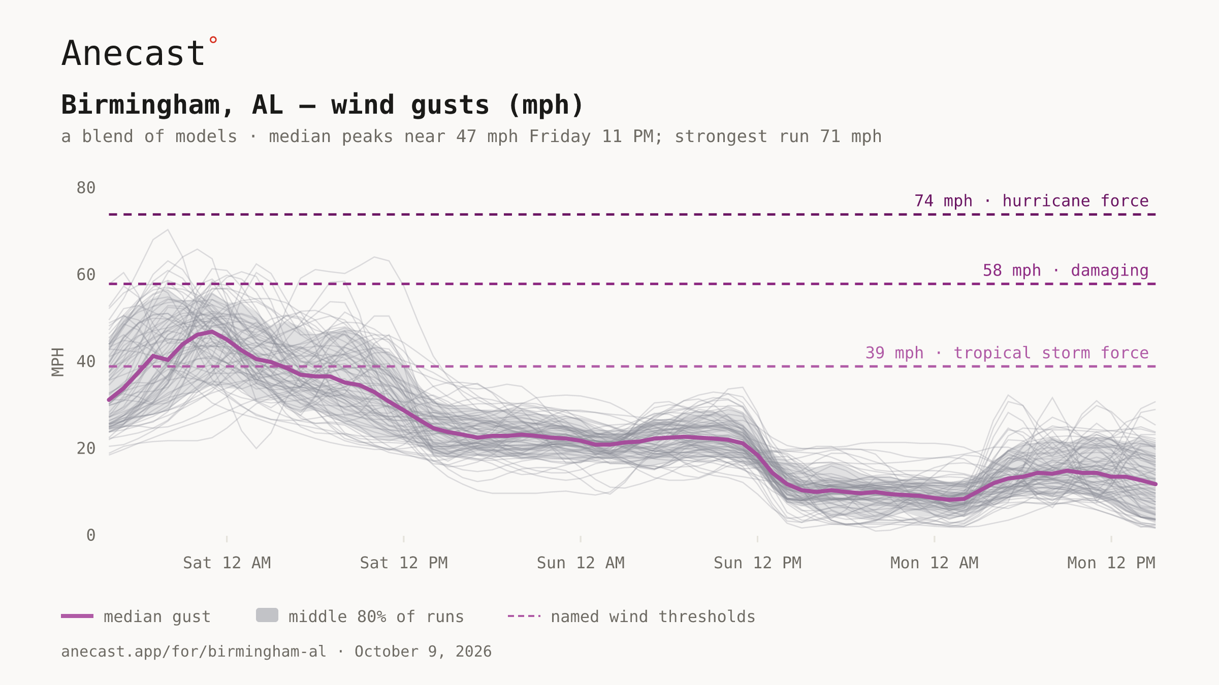
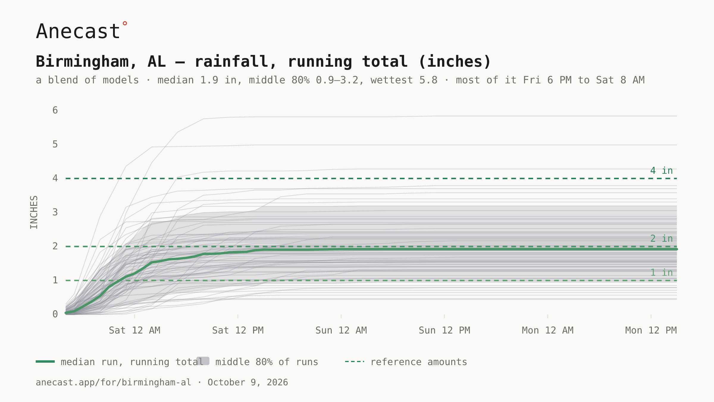
The latest 82 runs put Birmingham's peak gusts around 47 mph near 11 PM tonight, up from earlier runs, with the strongest at 71. Rain centers on 2 inches, mostly 1.1 to 3.4 and as much as 5.9, nearly all of it between 6 PM tonight and 7 AM Saturday.
wind · rain · isaias
Wind gusts (mph) · next 3 days, hourly · a blend of models
Saturday's tornado risk sits east of I-65, highest toward the Georgia line, as a warm front lifts north in the morning; isolated storms could redevelop into the afternoon and evening.
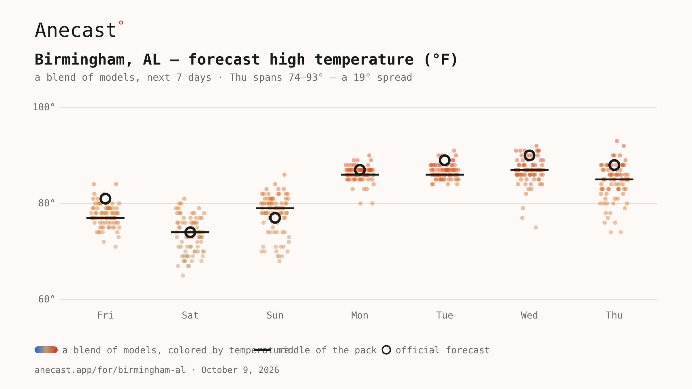
By Thursday the storm is long gone, but highs could land anywhere from 74 to 93 across 82 runs as high pressure builds back in, with the middle of the pack near 85.
spread · thursday
Forecast high temperature (°F) · next 7 days · a blend of models