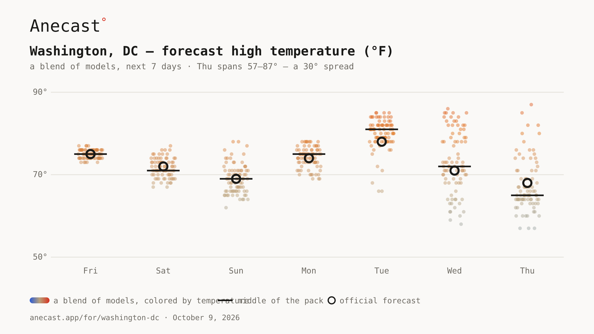
Columbus Day rain 43%→28% Tuesday 74°→78° Wednesday 64°→71°
Next five days
Fri
Sat
Sun
Mon
Tue
High
75°
72°
69°
75°
80°
Low
55°
60°
63°
63°
60°
Precip
0%
66%
99%
28%
14%
Highs tinted vs today's normal
(71°):
8° below 8° above
The scorecard · this week
M
T
W
T
F
S
S
1 of 2 days inside the band · bands ±2.5°F · gauge DCA
Worth knowing today
Columbus Day rain odds have dropped back to 28% from this morning's 66%, as the remnants of Isaias now look to push offshore Monday morning, leaving just a chance of early showers before partly sunny skies and a high near 75. The soaking still lands on Sunday: chances sit at 99%, with an isolated tornado risk as the remnant low moves through.
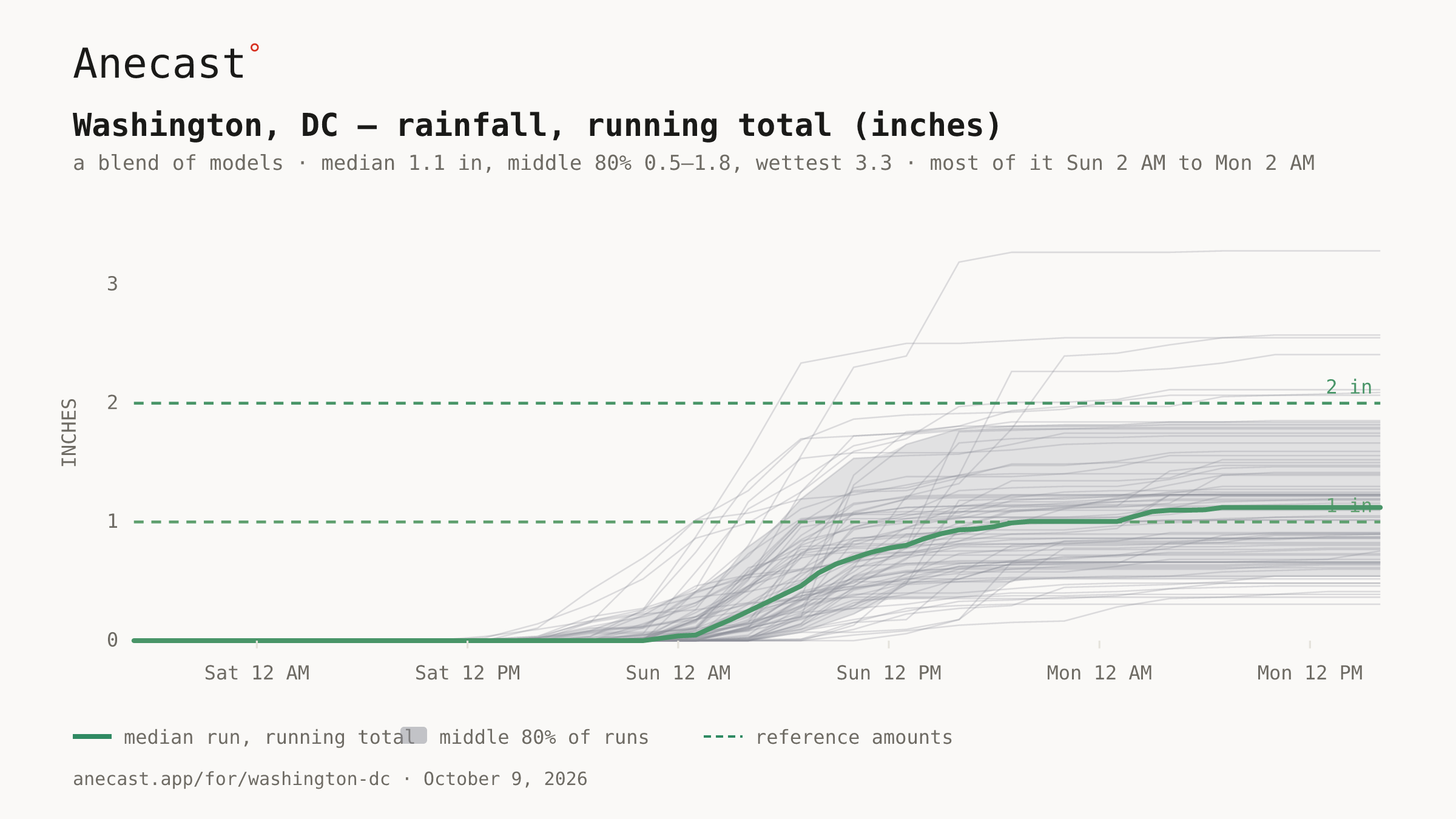
Most of Washington's rain falls between 2 AM Sunday and 2 AM Monday, with a typical run near 1.1 inches and a range of 0.5 to 1.8; this date's wettest on record is 1.02 inches (records since 1851).
rain · isaias
Rainfall, running total (inches) · next 3 days · a blend of models
⚡ Updated 18:07z — Columbus Day rain 66%→28% · Written 2026-10-09 · grounded in station records · tomorrow morning: what today's forecast said, next to what happened.
Today in station history (7 stats, records back decades)
Stat
Value
Year(s)
record high for day
93.9
2007
record low for day
34
1889
average high for day
70.8
—
average low for day
51.6
—
warmest low for day
73.9
2017
coldest high for day
48
1917
largest temp swing for day
37.9
1905
Get the morning edition
One city, one email a day — and the receipt the morning after. Unsubscribe anytime.
Missing your city?
New cities come online fast — a request is how places jump the queue.