79° sunny
Fort Collins was already at 79 by noon and should peak around 83 by late afternoon, well above normal for October. Southwest breezes keep the fire danger elevated through the evening, with skies turning mostly cloudy tonight and a low near 57.
Warm run holds Sunday and Columbus Day
Fort Collins, every morning, in one email. Get the edition
Changed since yesterday
Holding steady — no day's high or rain chance moved since yesterday's edition.
Next five days
| Sat | Sun | Mon | Tue | Wed | |
|---|---|---|---|---|---|
| High | 83° | 80° | 79° | 67° | 60° |
| Low | 56° | 54° | 51° | 48° | 44° |
| Precip | 4% | 4% | 22% | 60% | 61% |
The week, as the models see it
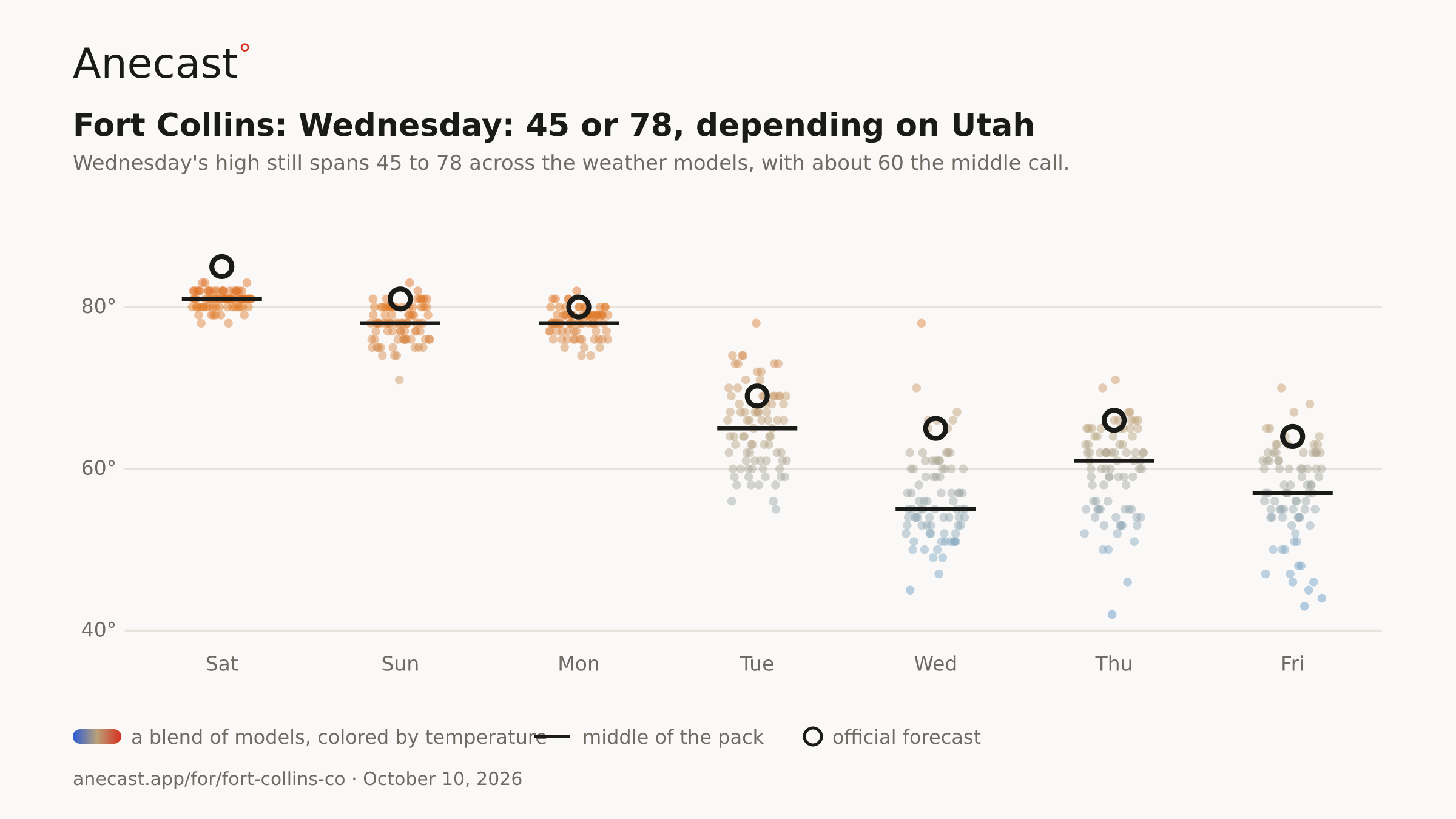
Wednesday: 45 or 78, depending on Utah — the models span 45–78° on Wed, most near 55°.
The scorecard · this week
Also worth knowing
High clouds could shave a few degrees off Sunday, which should still reach about 80, and Columbus Day looks like 79 under sunny skies. A cool front is expected to stall over the far northeast plains Monday, buying one more warm day.
The front should finally push through Monday night, dropping Tuesday to about 67, closer to seasonal levels. Showers and storms look likely Tuesday night at 60%.
Wednesday's high still spans 45 to 78 across the weather models, with about 60 the middle call. A slow-moving low over Utah decides it: a quick exit to Wyoming versus a stall that keeps Fort Collins cool and showery, possibly with mountain snow.
Yesterday's receipt
Get the morning edition
Missing your city?