32° light snow and fog/mist
Alerts · National Weather Service
Heavy snow and patchy blowing snow are setting in over Great Falls tonight, with temperatures sliding from 36 at 6 PM to near 28 by morning. A band of snow parked over central Montana barely moves through the next two days, and the wet, heavy load on leafy branches and power lines is the main hazard.
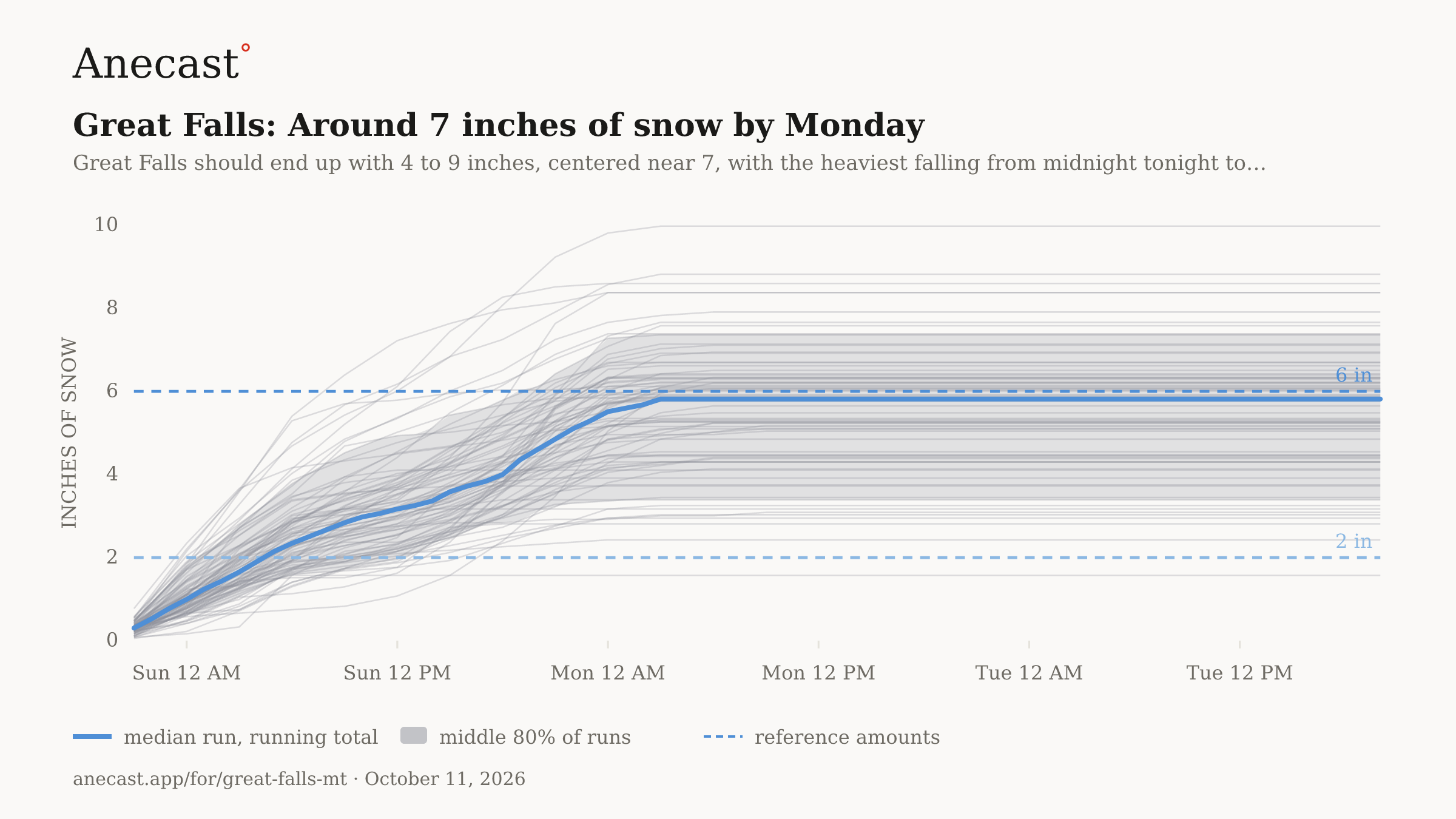
Around 7 inches of snow by Monday
Know when Great Falls's forecast changes: one email every morning. Get the morning edition
Changed since yesterday
Holding steady — no day's high or rain chance moved since yesterday's edition.
Next five days
| Sun | Mon | Tue | Wed | Thu | |
|---|---|---|---|---|---|
| High | 34° | 35° | 43° | 50° | 54° |
| Low | 29° | 25° | 27° | 31° | 33° |
| Precip | ❄ 100% | ❄ 65% | 0% | 14% | 20% |
| Alerts |
The week, as the models see it
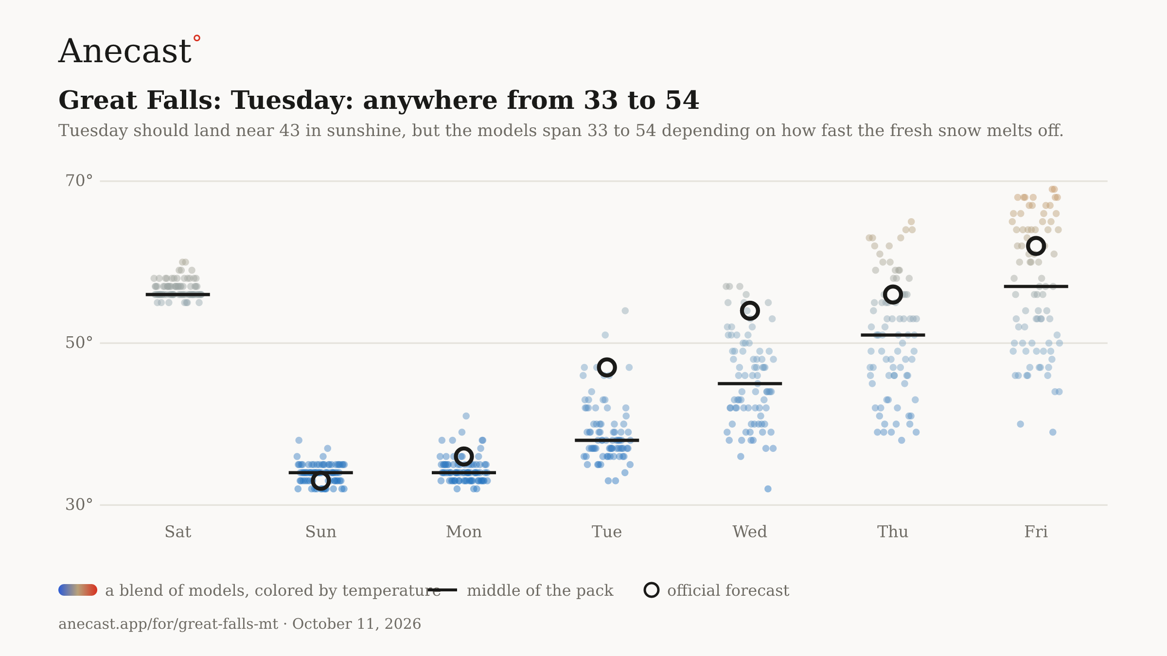
Tuesday: anywhere from 33 to 54 — the models span 33–54° on Tue, most near 38°.
The scorecard · this week
Also worth knowing
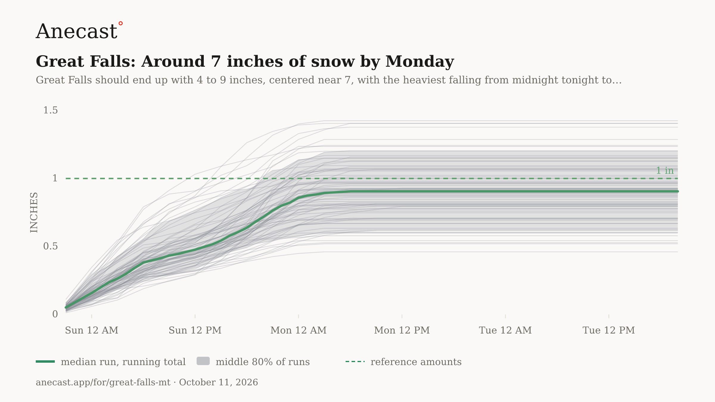
Great Falls should end up with 4 to 9 inches, centered near 7, with the heaviest falling from midnight tonight to 3 AM Monday; the snowiest model goes to a foot. Melted down, that is about an inch of water, and grass will stack it up faster than still-warm pavement.
Sunday looks like a high near 34 under steady snow, and Columbus Day only about 35 as light snow tapers off to clouds. Remnants of Rachel feed extra moisture into the storm before it winds down Monday.
Tuesday should land near 43 in sunshine, but the models span 33 to 54 depending on how fast the fresh snow melts off. It follows what could be the coldest night of the week, with teens possible and single digits in spots.
Yesterday's receipt
Know when Great Falls's forecast changes
Missing your city?