67°clear
Your day · tomorrow
Warm and sunny start, hot and sunny by afternoon, cooling off after dark.
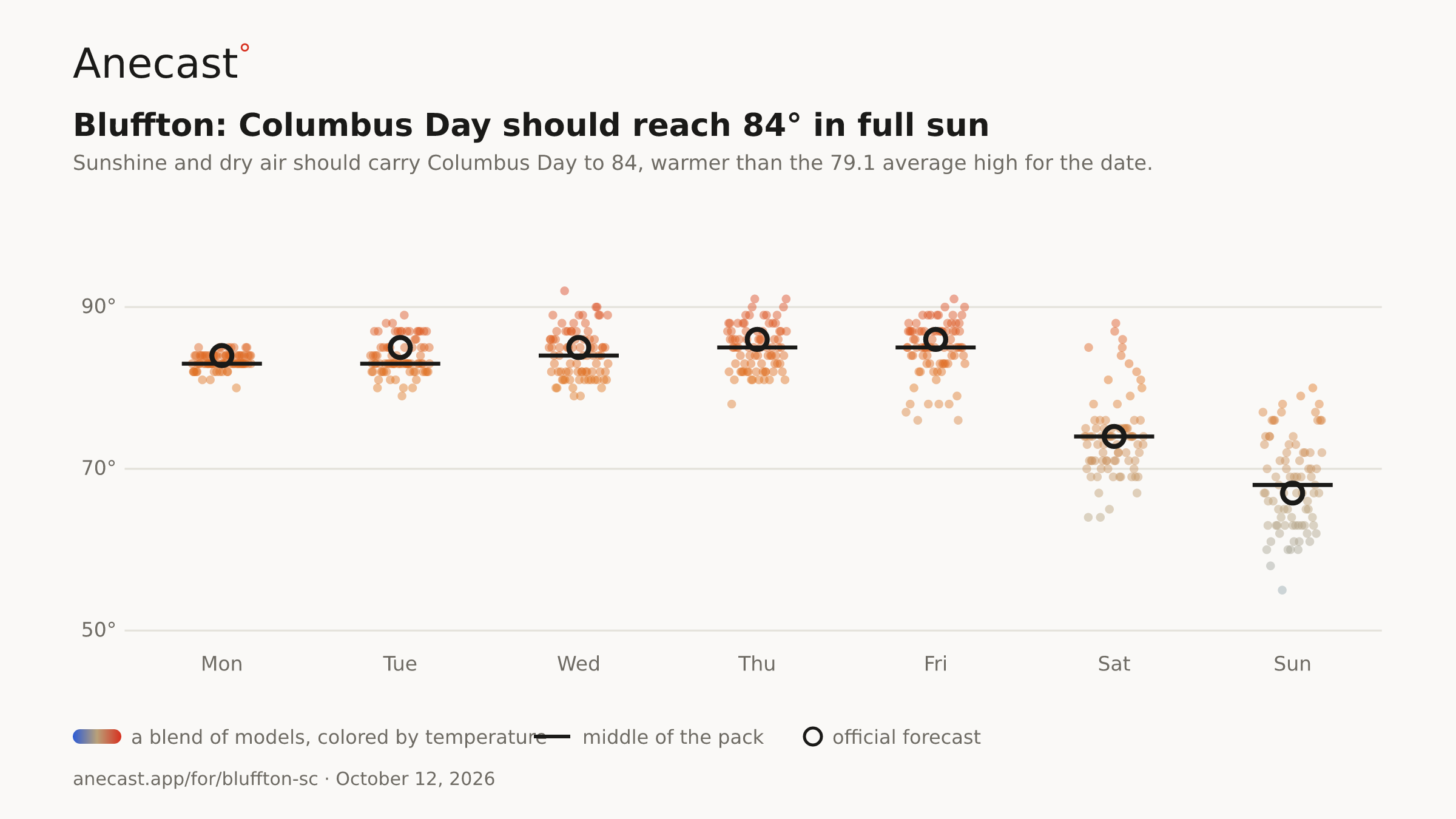
Sunshine and dry air should carry Columbus Day to 84, warmer than the 79.1 average high for the date. The models keep it tight, 80 to 85.
Know when Bluffton's forecast changes: one email every morning. Get the morning edition
Forecast changes since yesterday
Holding steady — no day's high or rain chance moved since yesterday's edition.
Next five days
| Mon | Tue | Wed | Thu | Fri | |
|---|---|---|---|---|---|
| High | 84° | 84° | 85° | 86° | 86° |
| Low | 65° | 66° | 67° | 68° | 67° |
| Precip | 0% | 0% | 1% | 3% | 4% |
The week, as the models see it
Columbus Day should reach 84° in full sun — the models span 79–92° on Wed, most near 84°.
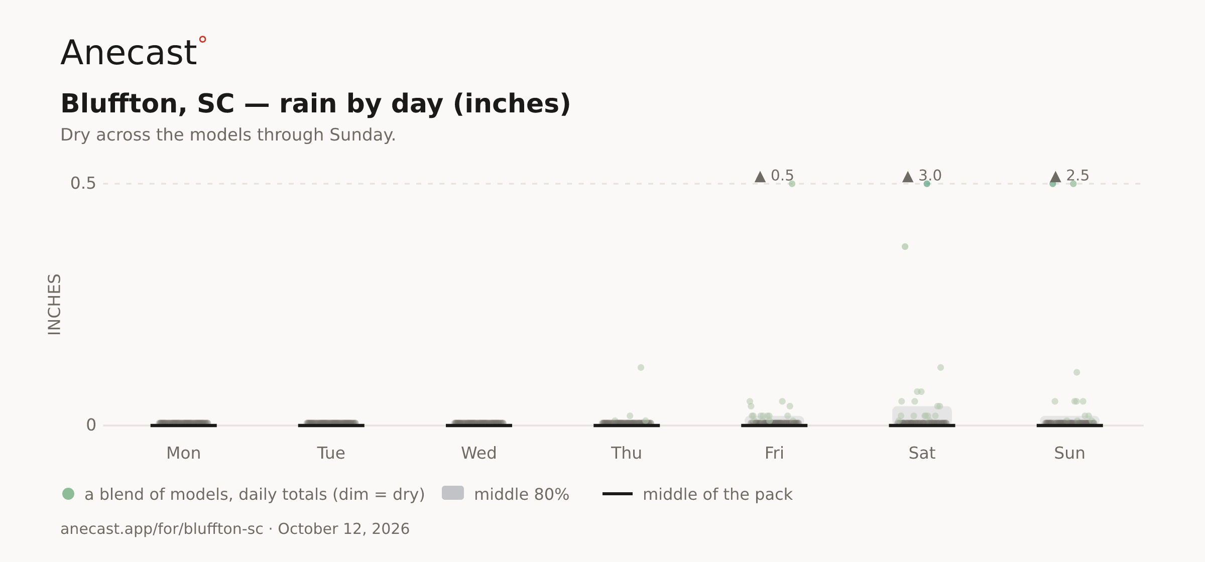
Sunday is the wettest: the models center on 0.2 in, most between 0.1 and 0.4, the wettest 1.1.
| Stat | Value | Year(s) |
|---|---|---|
| record high for day | 90 | 2018, 2020 |
| record low for day | 39.9 | 2000 |
| average high for day | 79.1 | — |
| average low for day | 59.7 | — |
| warmest low for day | 75.9 | 2020 |
| coldest high for day | 60.1 | 1994 |
| largest temp swing for day | 36 | 1965 |
The scorecard · this week
The front and Isaias's leftovers have cleared out, and Bluffton should slide to about 65 by dawn under mostly clear skies. That sits roughly 5 degrees above the 59.7 average low for the date (records since 1948).
Wednesday looks like 85, but the models still span 79 to 92, hinging on how strongly high pressure pushes east from the central US midweek. A strong ridge puts the warm end within reach of near-record heat later in the week.
Rain chances stay at 2% or less through Thursday, with highs near 86 by then. A cold front should break the warm spell this weekend, and Saturday's 74 still carries a wide 64-to-88 range in the models.
Know when Bluffton's forecast changes
Missing your city?