54°cloudy
Alerts · National Weather Service
Your day · tomorrow
Cool and areas of blowing dust start, mild by afternoon with storms, storms possible.
Salt Lake City is under a Flood Watch until 6 PM Monday as moisture from the remnants of Tropical Storm Rachel feeds a slow-moving low; a Flood Advisory runs until 9:30 PM tonight for poor drainage areas near 9th South and 9th East. Tonight carries a 97% chance of showers and thunderstorms, with the wind advisory ending at 9 PM.
Know when Salt Lake City's forecast changes: one email every morning. Get the morning edition
Forecast changes since yesterday
Holding steady — no day's high or rain chance moved since yesterday's edition.
Next five days
| Mon | Tue | Wed | Thu | Fri | |
|---|---|---|---|---|---|
| High | 61° | 52° | 55° | 61° | 66° |
| Low | 47° | 43° | 41° | 42° | 44° |
| Precip | 89% | 94% | 61% | 4% | 1% |
| Alerts |
The week, as the models see it
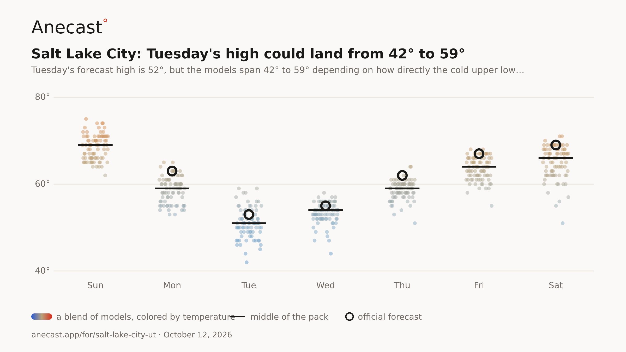
Tuesday's high could land from 42° to 59° — the models span 42–59° on Tue, most near 51°.
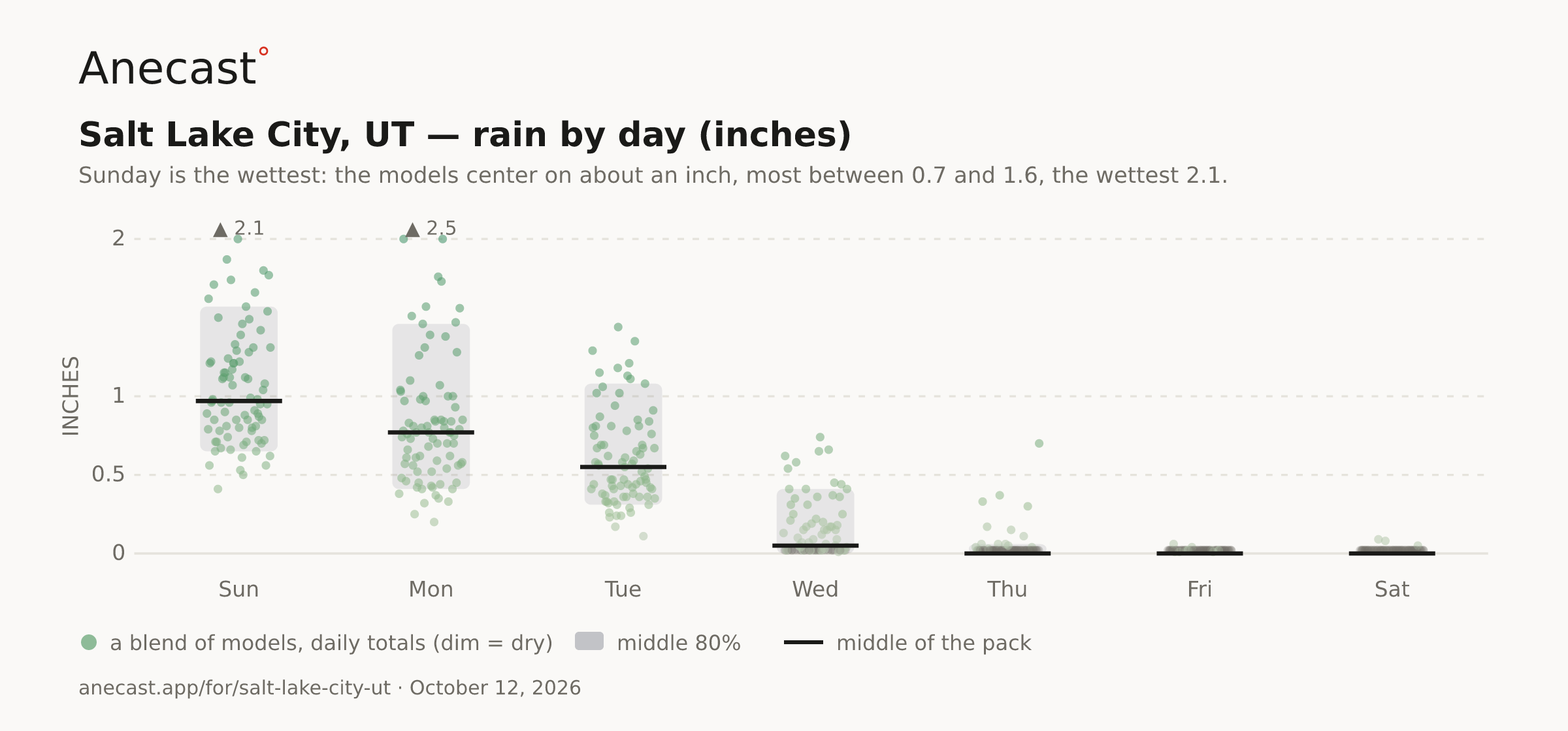
Sunday is the wettest: the models center on about an inch, most between 0.7 and 1.6, the wettest 2.1.
The scorecard · this week
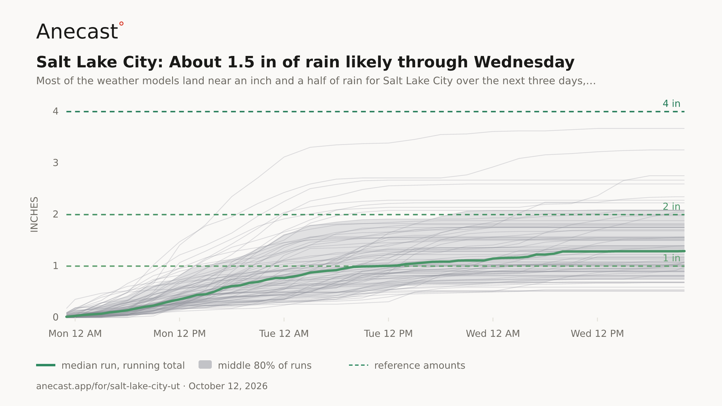
Most of the weather models land near an inch and a half of rain for Salt Lake City over the next three days, anywhere from about an inch to over 2 inches, with most falling Monday morning through early Wednesday. Heavy rain tracking over a population center could bring urban flooding, while gusts should stay modest, near 20 mph, with the strongest model near 40 mph.
Tuesday's forecast high is 52°, but the models span 42° to 59° depending on how directly the cold upper low settles overhead and lowers snow levels. Accumulating snow could reach the Upper Cottonwoods above 8,000 feet.
High pressure brings a warming, drying trend late week; Thursday's forecast high is 61° under mostly sunny skies with just a 4% rain chance.
Know when Salt Lake City's forecast changes
Missing your city?