72°partly cloudy
Your day
Mild and mostly sunny this morning, then warm with storms and showers possible through the afternoon and gray by evening; stronger storms could bring lightning, gusty winds and isolated flash flooding.
Sunday's 1.08 inches of rain in Las Vegas was the most ever recorded on October 11, past the 0.78 inches from 2012, as the remnants of Tropical Storm Rachel moved through. That one day delivered about half of the year's 2.18 inches so far.
Know when Las Vegas's forecast changes: one email every morning. Get the morning edition
Forecast changes since yesterday
Holding steady — no day's high or rain chance moved since yesterday's edition.
Next five days
| Mon | Tue | Wed | Thu | Fri | |
|---|---|---|---|---|---|
| High | 70° | 65° | 72° | 76° | 78° |
| Low | 56° | 53° | 56° | 59° | 60° |
| Precip | 18% | 17% | 0% | 0% | 6% |
The week, as the models see it
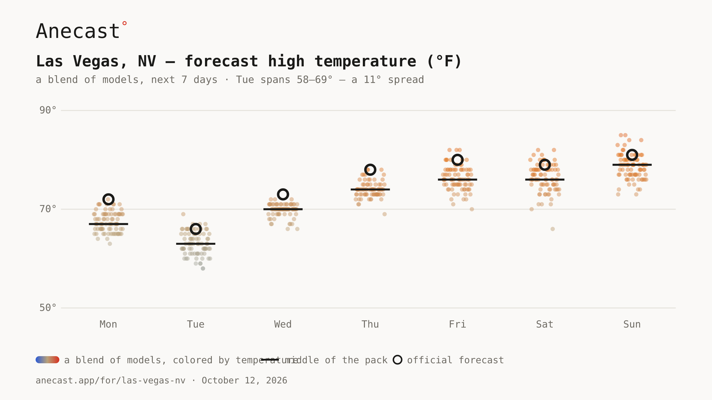
The models mostly agree this week. The widest day, Tue, spans 58–69°.
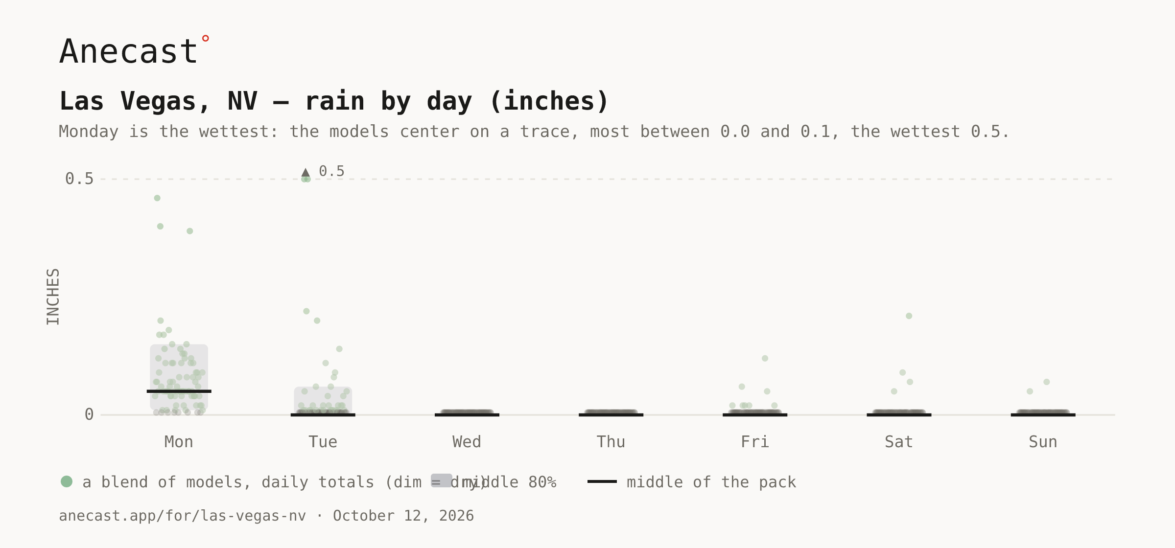
Monday is the wettest: the models center on a trace, most between 0.0 and 0.1, the wettest 0.5.
‹The scorecard · this week›
A slow-moving upper trough keeps isolated showers and thunderstorms possible this afternoon, with a stationary front parked just 30 miles northeast of Las Vegas. Moisture is thinner than Sunday's, but stronger storms could still bring lightning, brief heavy rain and isolated flash flooding, with southerly gusts of 25 to 40 mph.
A cold front swings through Tuesday, turning winds northwest and holding the forecast high to 65°, after a forecast low near 54° tonight. Breezy northerly winds linger through the work week before Thursday's high climbs back to 76°.
Know when Las Vegas's forecast changes
Missing your city?