59°cloudy
Tonight's rain chance climbs to 51% around midnight in Provincetown as low pressure tracking across northern New England drags a second round of showers south onto the Cape. The air won't cool off: temperatures should actually tick up to about 62° by 1 AM as the wind turns southwest.
Know when Provincetown's forecast changes: one email every morning. Get the morning edition
Forecast changes since yesterday
Holding steady — no day's high or rain chance moved since yesterday's edition.
Next five days
| Tue | Wed | Thu | Fri | Sat | |
|---|---|---|---|---|---|
| High | 62° | 68° | 60° | 64° | 55° |
| Low | 58° | 58° | 53° | 50° | 44° |
| Precip | 51% | 3% | 9% | 95% | 15% |
The week, as the models see it
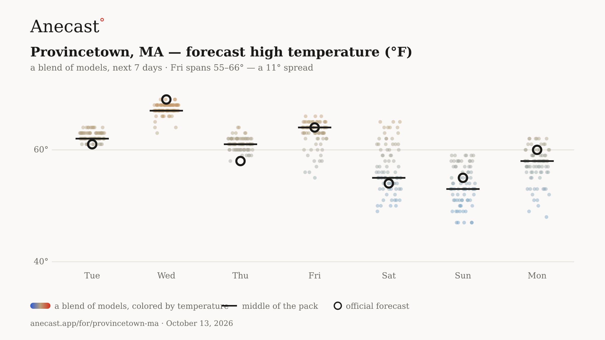
The models mostly agree this week. The widest day, Fri, spans 55–66°.
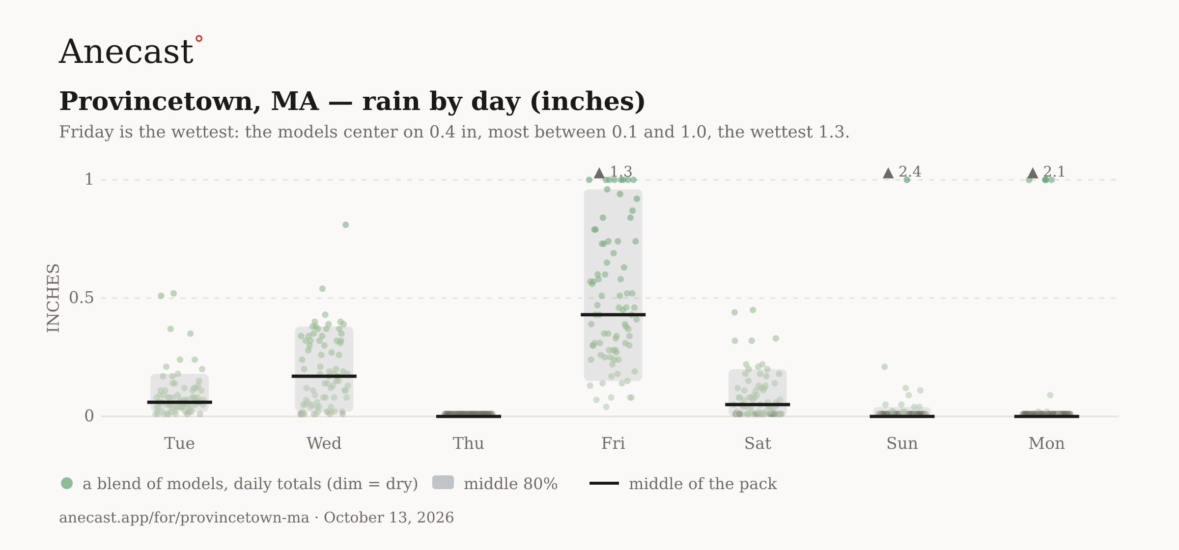
Friday is the wettest: the models center on 0.4 in, most between 0.1 and 1.0, the wettest 1.3.
Wednesday's forecast high is 68°, the warmest day of the week, before drier Ontario air knocks Thursday's high back to 60°. An isolated afternoon shower can't be ruled out Wednesday as the trailing cold front passes.
Rain should arrive Friday morning, with most of the models near a half inch of rain and a range from a couple tenths to nearly an inch. Gusts near 35 mph look likely Friday, and the strongest model reaches about 55 mph.
Saturday's forecast high is 55° as a strong cold front pushes through in the morning and air near freezing about 2,500 feet up pours in on northwest winds. Gusts to 45 mph are possible across the region in its wake.
Know when Provincetown's forecast changes
Missing your city?