Where the weather is: Miami — Flood Watch · Cleveland — the 13-day run above normal ended · New Orleans — a record yesterday: yesterday's 1.14 inches of rain is the most rain on record for the date (past the 0.89 inches from 1979) · Baltimore — the 6-day run above normal ended · Pittsburgh — the 12-day run above normal ended · Rochester — Wed 20° above normal
Weather worth knowing

Steamboat Springs, CO

Sunday, November 1

53°rain showers likely

Your day

Cold early, warming fast to the mid 50s, then rain through midday and storms possible this afternoon and evening; tonight's falling snow levels could make Monday morning's pass travel sloppy.

MORNING32–45°MIDDAY49–54°AFTERNOON50–54°EVENING41–47°↑ 6:37 AM↓ 5:03 PMNOW
MORNING32–45°MIDDAY49–54°AFT'NOON50–54°EVENING41–47°↑ 6:37 AM↓ 5:03 PMNOW
Morning
cold, warming fast
bundle up early
Midday
showers, cool
rain through midday
Afternoon
storms, cool
storms possible
Evening
storms, cool
storms possible

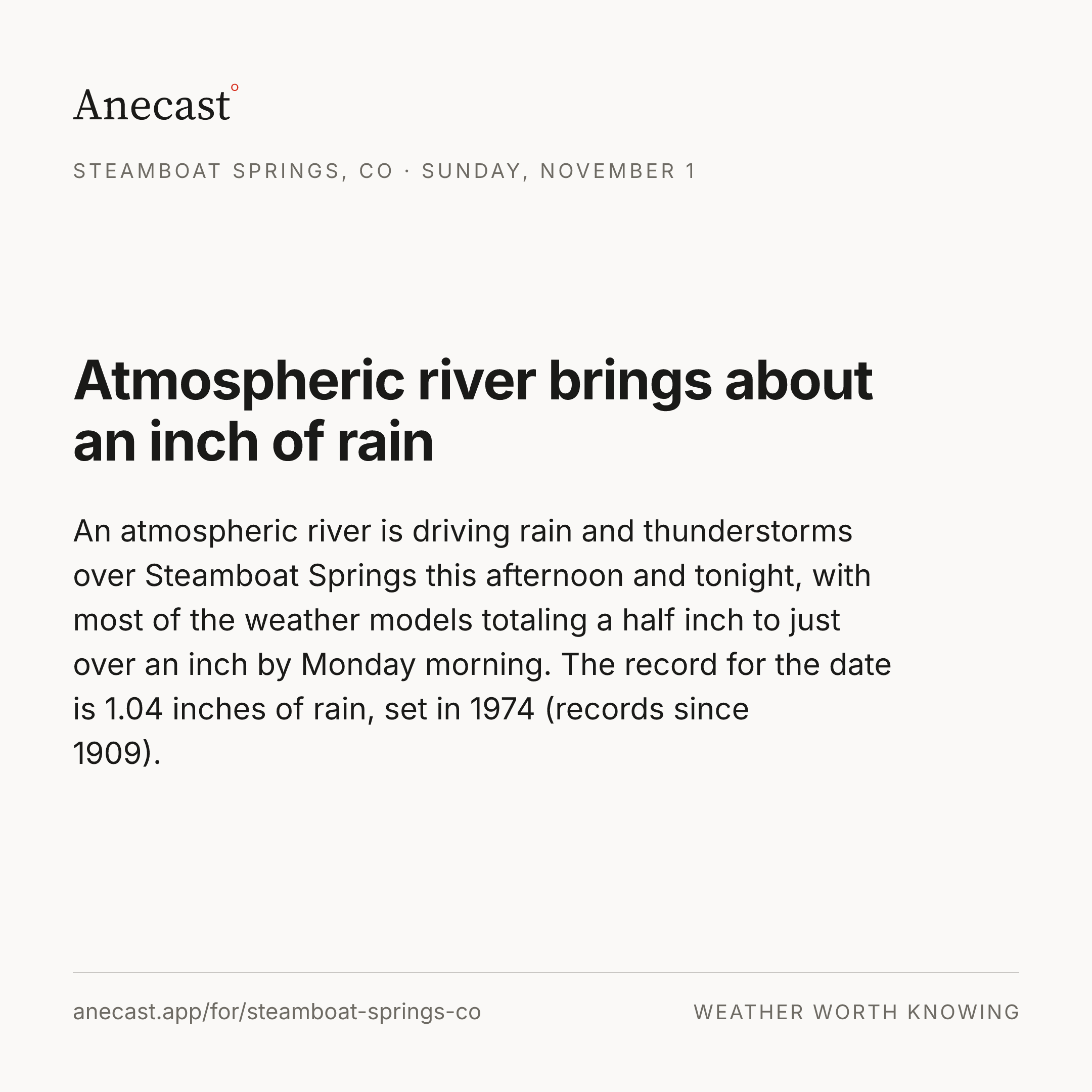
Atmospheric river brings about an inch of rain

An atmospheric river is driving rain and thunderstorms over Steamboat Springs this afternoon and tonight, with most of the weather models totaling a half inch to just over an inch by Monday morning. The record for the date is 1.04 inches of rain, set in 1974 (records since 1909).

rain · record
Worth knowing?
One email a day: Steamboat Springs's weather, worth knowing.

The week ahead

Changed since yesterday

Holding steady — no day's high or rain chance moved since yesterday's edition.

Next five days · the Anecast forecast

SunMonTueWedThu
High54°43°48°54°48°
Low32°29°27°29°28°
Precip100%❄ 98%4%❄ 41%❄ 15%

Highs tinted vs today's normal (50°): 8° below 8° above · ❄ frozen precip

The week, as the models see it

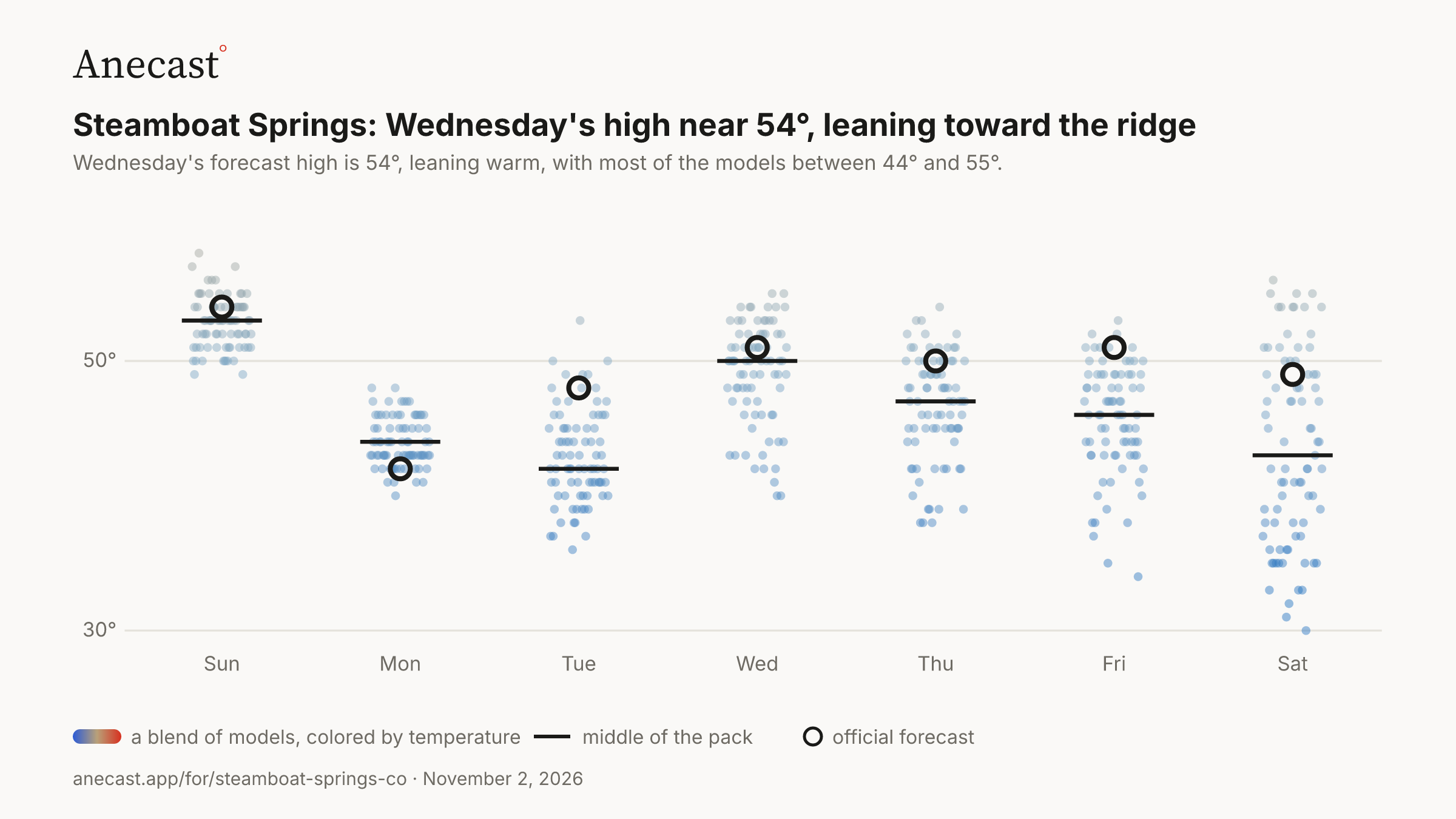
Wednesday's high near 54°, leaning toward the ridge — the models span 38–58° on Wed, most near 52°.

Forecast high temperature (°F) · next 7 days · a blend of models
PNG ↓
20°40°60°SunMonTueWedThuFriSat

82 model runs, colored by temperature  ·  middle of the pack  ·  NWS forecast

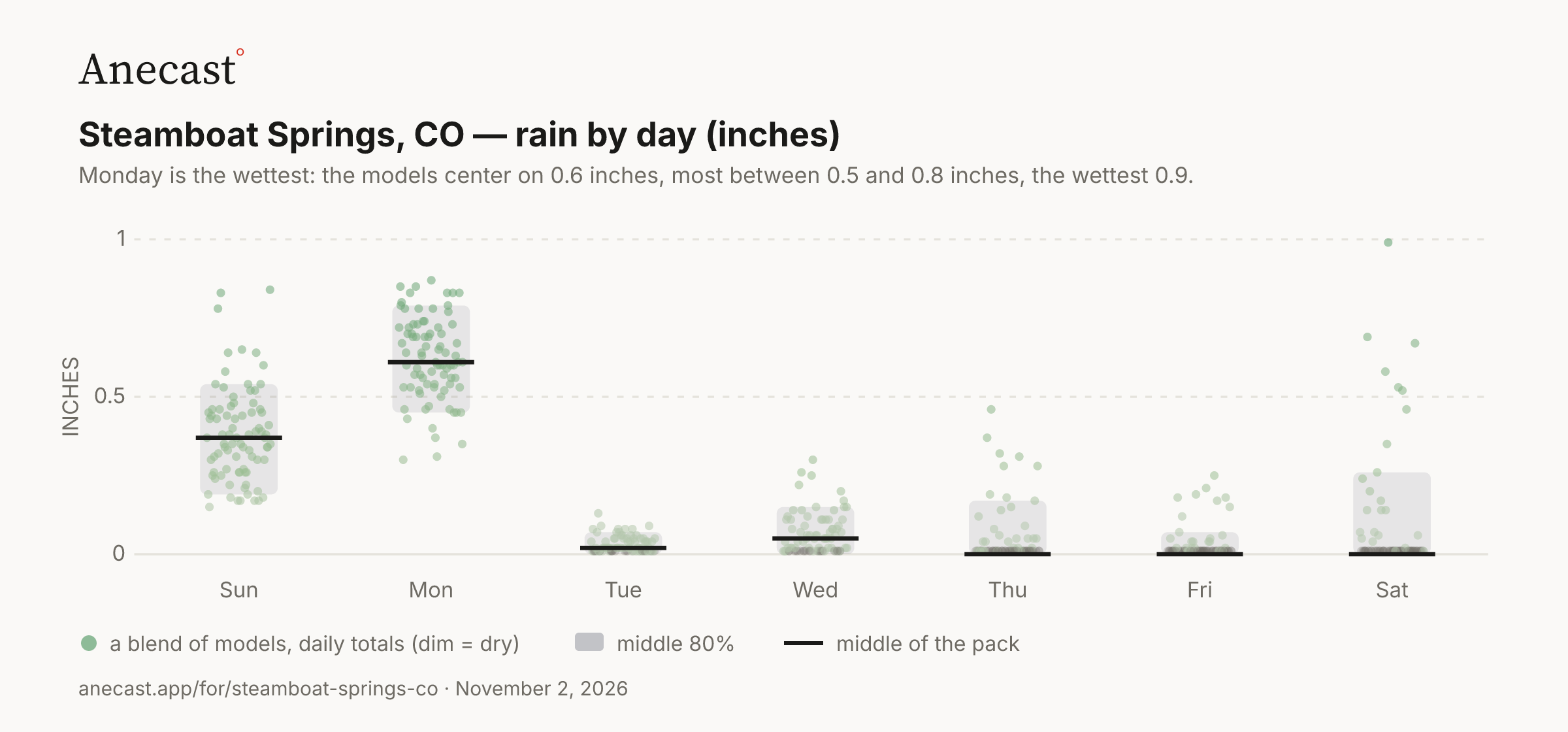
Monday is the wettest: the models center on 0.6 inches, most between 0.4 and 0.8 inches, the wettest 1.1.

Rain by day (inches) · next 7 days · a blend of models
PNG ↓
0.510SunMonTueWedThuFriSat▲ 1.1INCHES

82 model runs, daily totals (dim = dry)  ·  middle 80%  ·  middle of the pack

Today in station history (7 stats, records back decades)
StatValueYear(s)
record high for day 69.1 2008
record low for day -9 2019
average high for day 50.3 —
average low for day 21.2 —
warmest low for day 37.9 1998
coldest high for day 30 1972
largest temp swing for day 50 1909

Also worth knowing

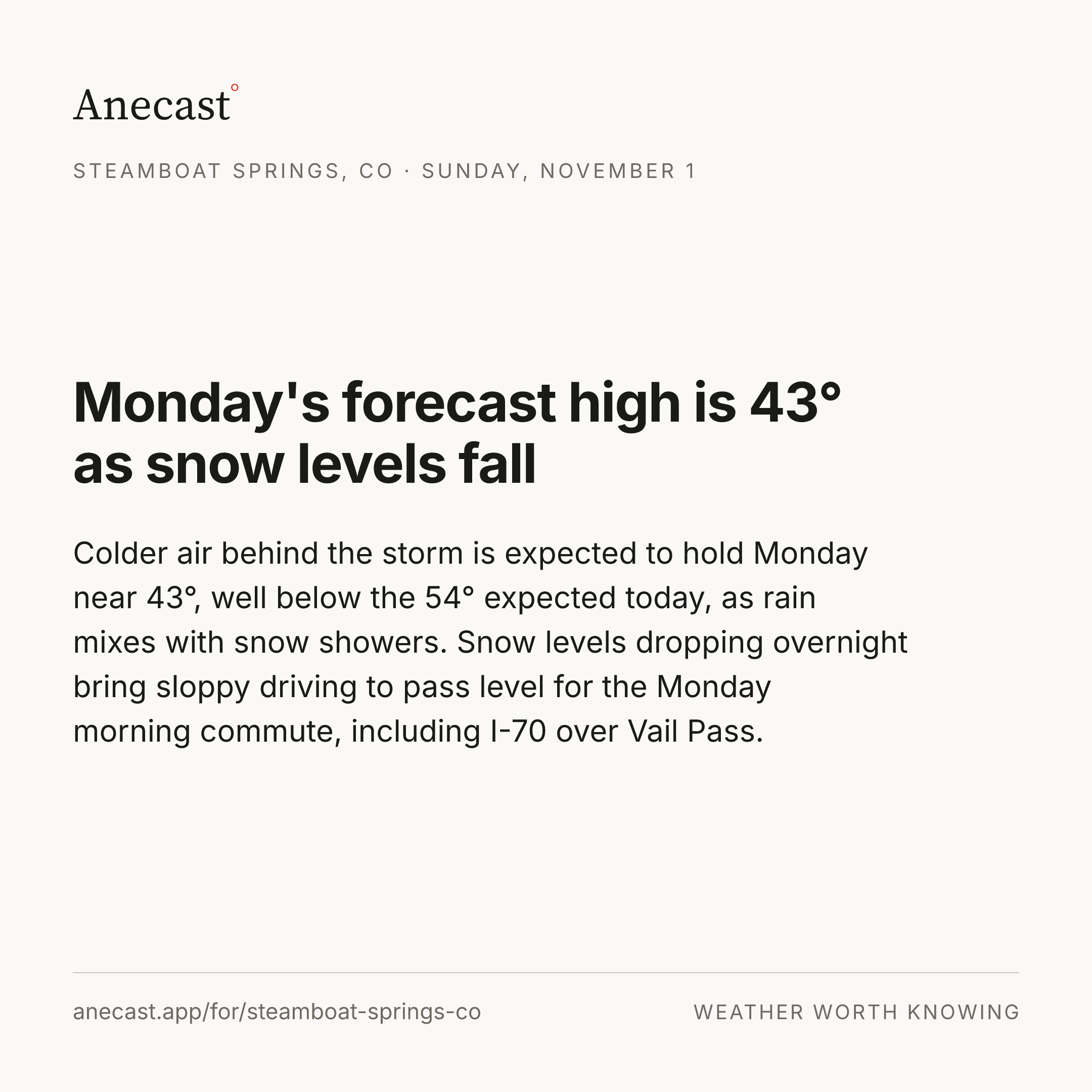
Monday's forecast high is 43° as snow levels fall

Colder air behind the storm is expected to hold Monday near 43°, well below the 54° expected today, as rain mixes with snow showers. Snow levels dropping overnight bring sloppy driving to pass level for the Monday morning commute, including I-70 over Vail Pass.

snow · travel
Worth knowing?

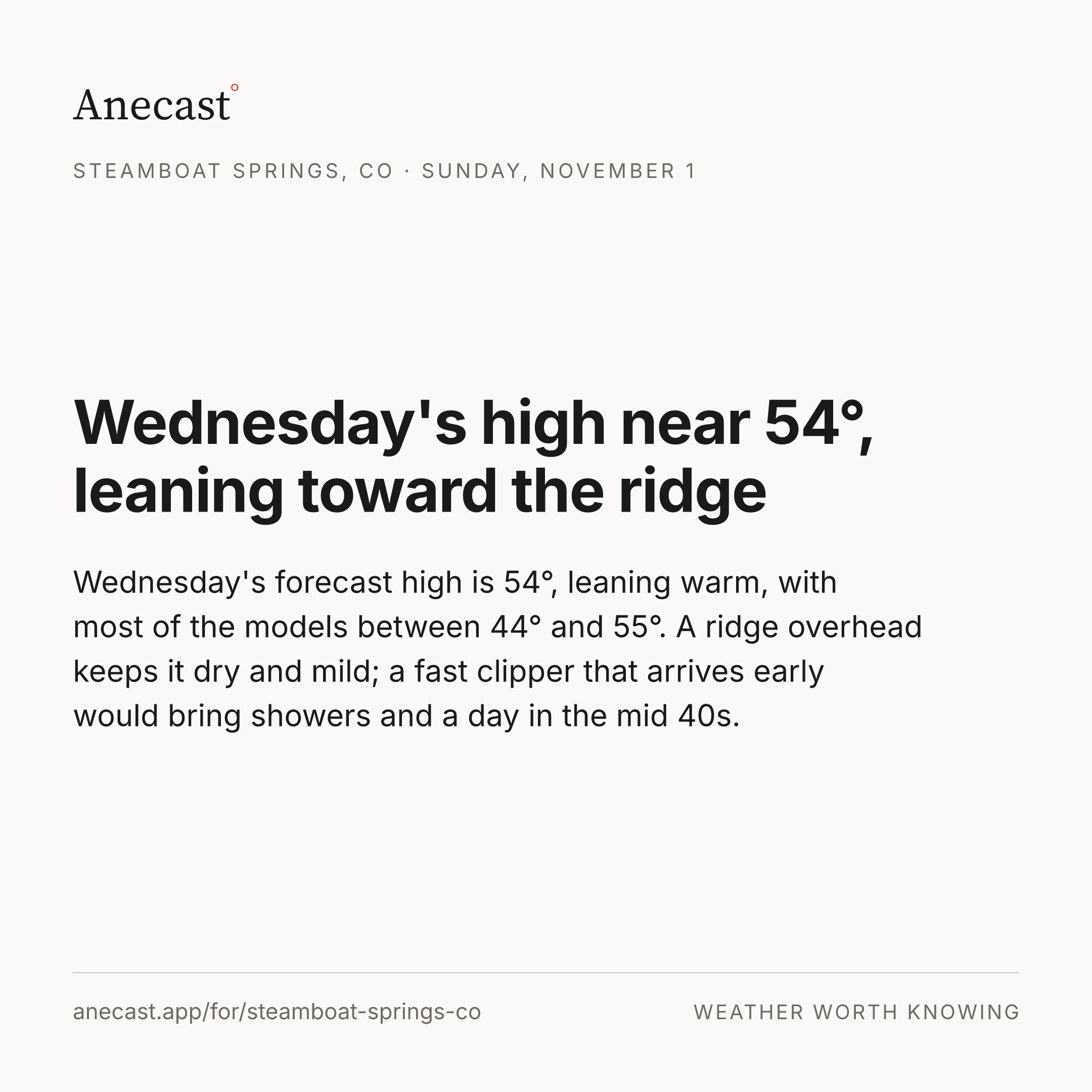
Wednesday's high near 54°, leaning toward the ridge

Wednesday's forecast high is 54°, leaning warm, with most of the models between 44° and 55°. A ridge overhead keeps it dry and mild; a fast clipper that arrives early would bring showers and a day in the mid 40s.

fork · ridge
Worth knowing?

Afternoon edition, 2026-11-01 · grounded in station records · tomorrow morning: what today's forecast said, next to what happened.

Yesterday's receipt

Every forecast here is kept, but Steamboat Springs has no reporting station on the roster yet, so there's nothing observed to grade against. That's next.

Keeping score

Know when Steamboat Springs's forecast changes

One email every morning: what changed overnight, what's unusual, and what yesterday's forecast got right or wrong. Free. Unsubscribe anytime.

Missing your city?

A request is how a place gets on the roster; the forecast tools already answer for anywhere in the US.