- Arlington, VA
- Atlanta, GA
- Austin, TX
- Baltimore, MD
- Birmingham, AL
- Bluffton, SC
- Boston, MA
- Boulder, CO
- Castle Rock, CO
- Centennial, CO
- Chicago, IL
- Cleveland, OH
- Colorado Springs, CO
- Dallas, TX
- Denver, CO
- Destin, FL
- Elizabeth, CO
- Fort Collins, CO
- Foxfield, CO
- Golden, CO
- Great Falls, MT
- Greeley, CO
- Highlands Ranch, CO
- Hilton Head Island, SC
- Larkspur, CO
- Las Vegas, NV
- Los Angeles, CA
- Miami, FL
- New Orleans, LA
- New York, NY
- Pensacola, FL
- Philadelphia, PA
- Pittsburgh, PA
- Plano, TX
- Provincetown, MA
- Rehoboth Beach, DE
- Richmond, VA
- Rochester, NY
- Salt Lake City, UT
- San Diego, CA
- San Francisco, CA
- Santa Fe, NM
- Savannah, GA
- Seattle, WA
- Sebastopol, CA
- South Lake Tahoe, CA
- Steamboat Springs, CO
- Stephenville, TX
- Tybee Island, GA
- Ukiah, CA
- Washington, DC
Larkspur, CO
36°clear
Warmer or cooler than yesterday in Larkspur?
17° cooler, and the wind drops.yesterday's forecast Forecast 54°, saw 57°. The receiptYour day
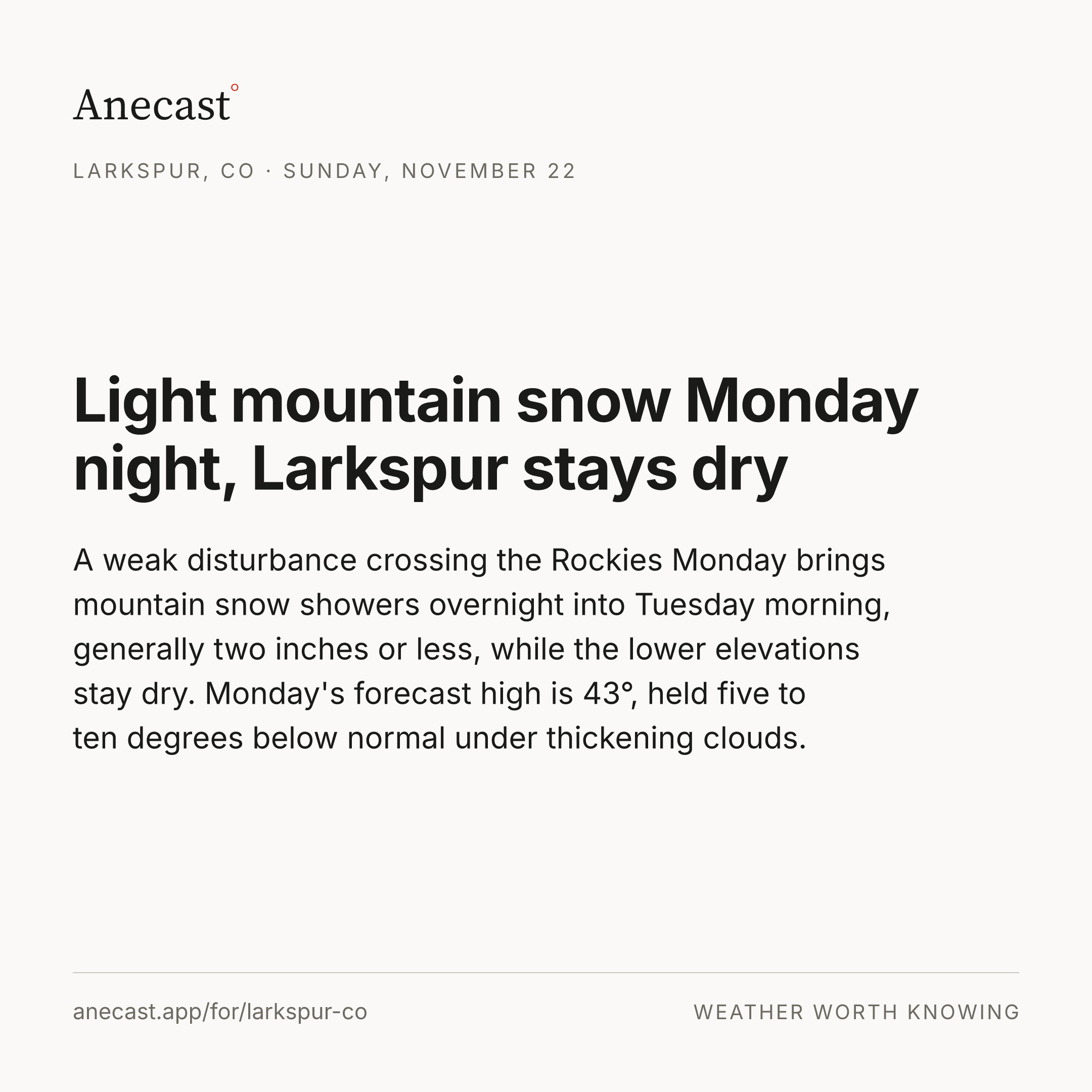
A frigid start with a chance of light snow this morning, cold and clearing by afternoon, then freezing tonight. Any snow is expected to be very low impact, a dusting at most.
Light snow possible this morning, mostly a dusting
A weakening trough crossing Colorado could set up a narrow band of light snow from the foothills across the Palmer Divide this morning, though dry air near the ground has to be overcome first. Most spots that see snow get a dusting at most, it clears out around noon, and today's forecast high is 40°, well under the 54.3° average for the date at the Castle Rock airport, Larkspur's official station (records since 1893).
Right now


The week ahead
Changed since yesterday
Next five days · the Anecast forecast
| Sat | Sun | Mon | Tue | Wed | |
|---|---|---|---|---|---|
| High | 40° | 45° | 45° | 45° | 53° |
| Low | 22° | 26° | 24° | 26° | 29° |
| Precip | ❄ 35% | 0% | ❄ 22% | 4% | 4% |
| Wind (mph) | 1–6 | 25gusts | 3 | 1–5 | 2–6 |
The week, as the models see it
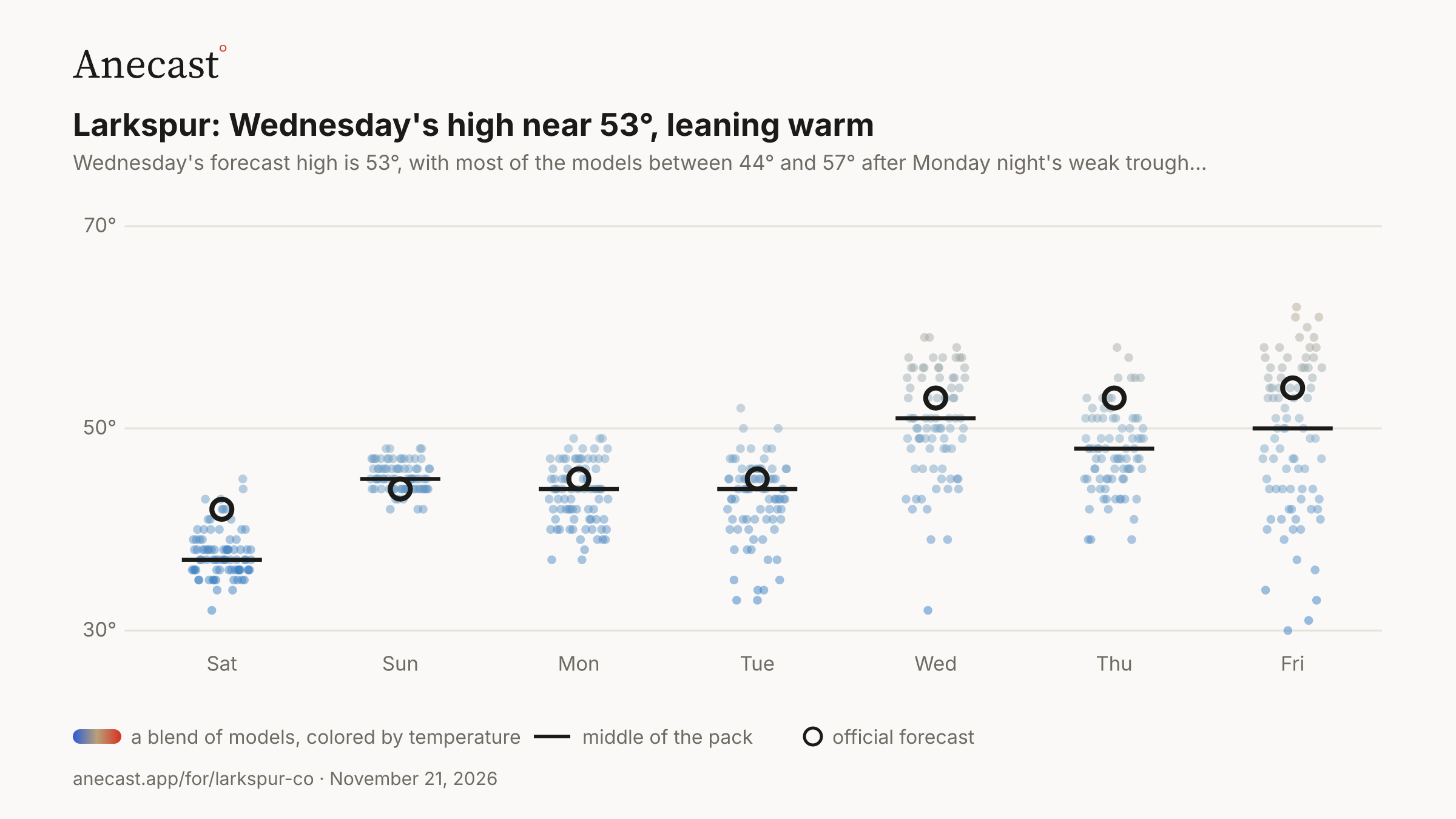
Wednesday's high near 53°, leaning warm — the models span 32–59° on Wed, most near 51°.
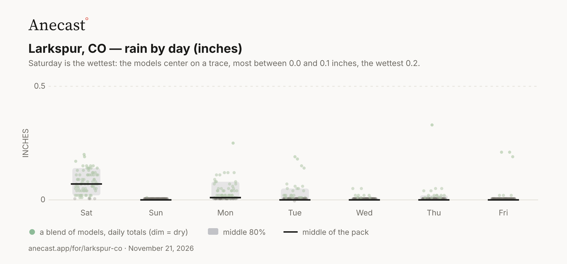
Saturday is the wettest: the models center on a trace, most between 0.0 and 0.1 inches, the wettest 0.2.
Today in station history (7 stats, records back decades)
| Stat | Value | Year(s) |
|---|---|---|
| record high for day | 73 | 2001 |
| record low for day | -2.9 | 1898 |
| average high for day | 54.3 | — |
| average low for day | 21.7 | — |
| warmest low for day | 45 | 2016 |
| coldest high for day | 27 | 1979 |
| largest temp swing for day | 54.9 | 2003 |
Also worth knowing
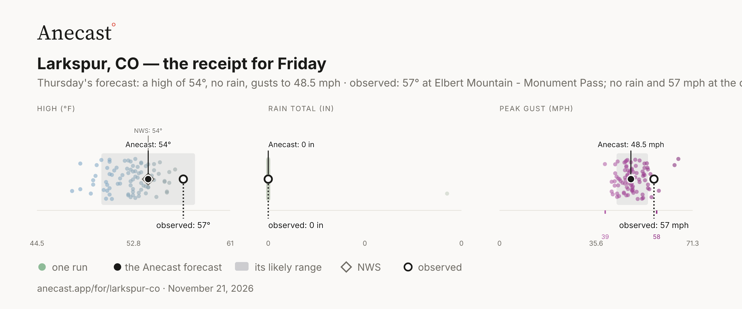
Friday ran 3° warmer than our 54° forecast
Friday's high reached 57° at Monument Pass against our 54° forecast, warmer than every weather model run Thursday, with gusts to 57 mph from the strong southwest jet. The official gauge at the Colorado Springs airport hit 62°.
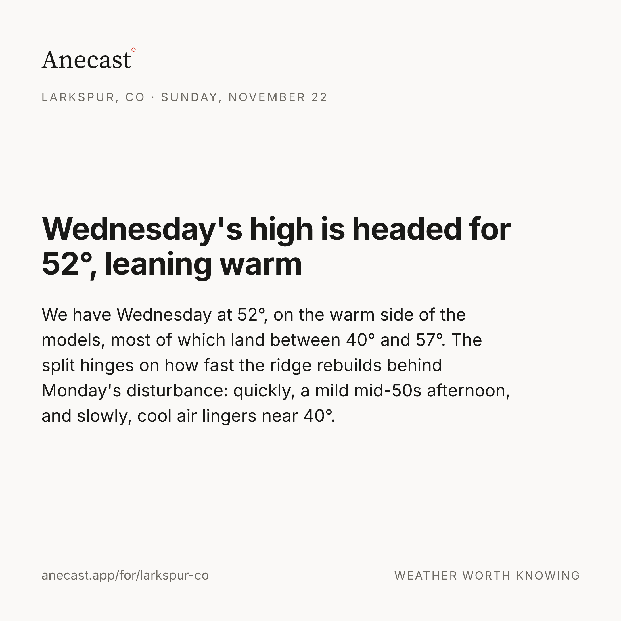
Wednesday's high near 53°, leaning warm
Wednesday's forecast high is 53°, with most of the models between 44° and 57° after Monday night's weak trough departs. If that system clears out fast and the drier, warmer trend arrives early, the upper 50s are in reach; if colder air lingers behind it, the day stays in the mid 40s.
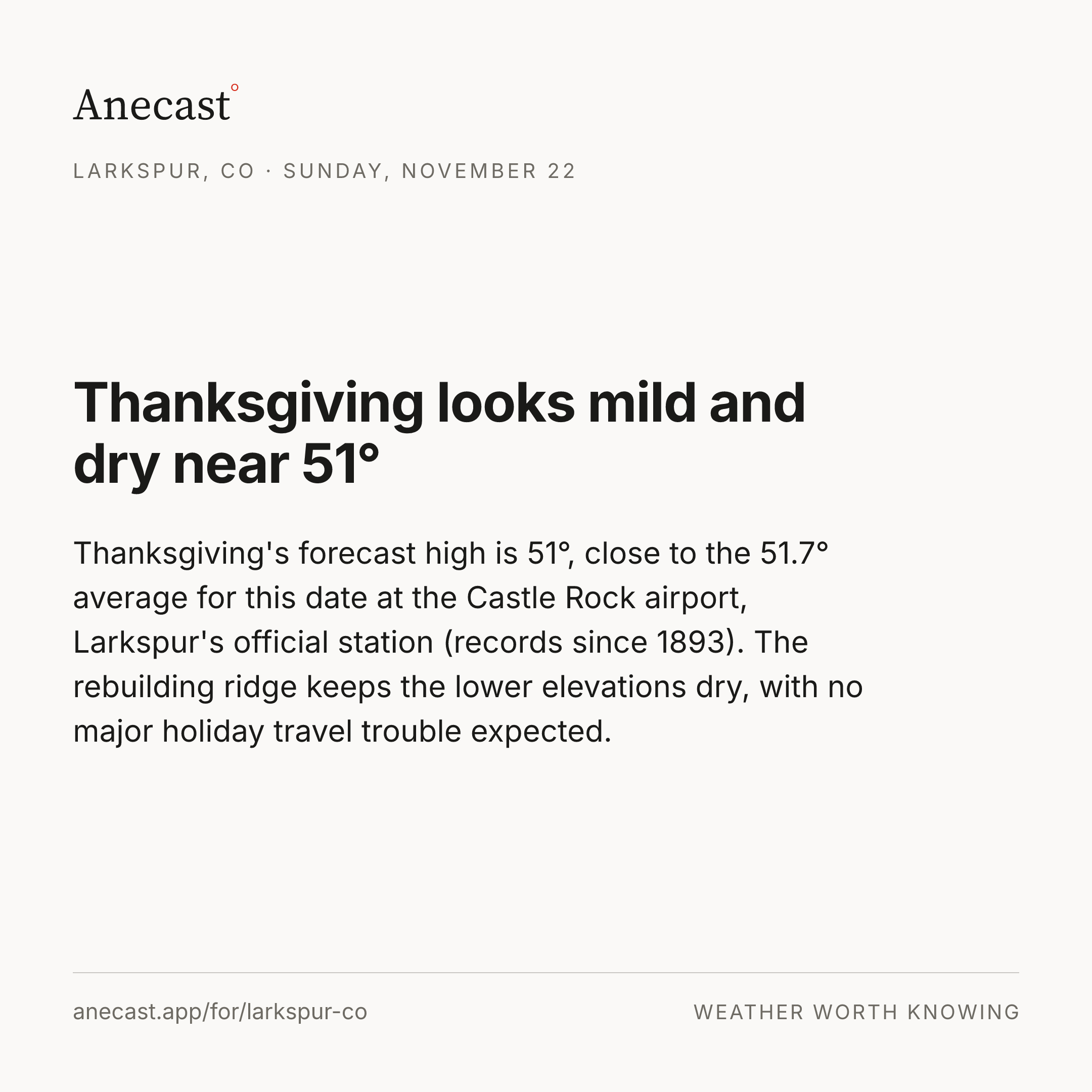
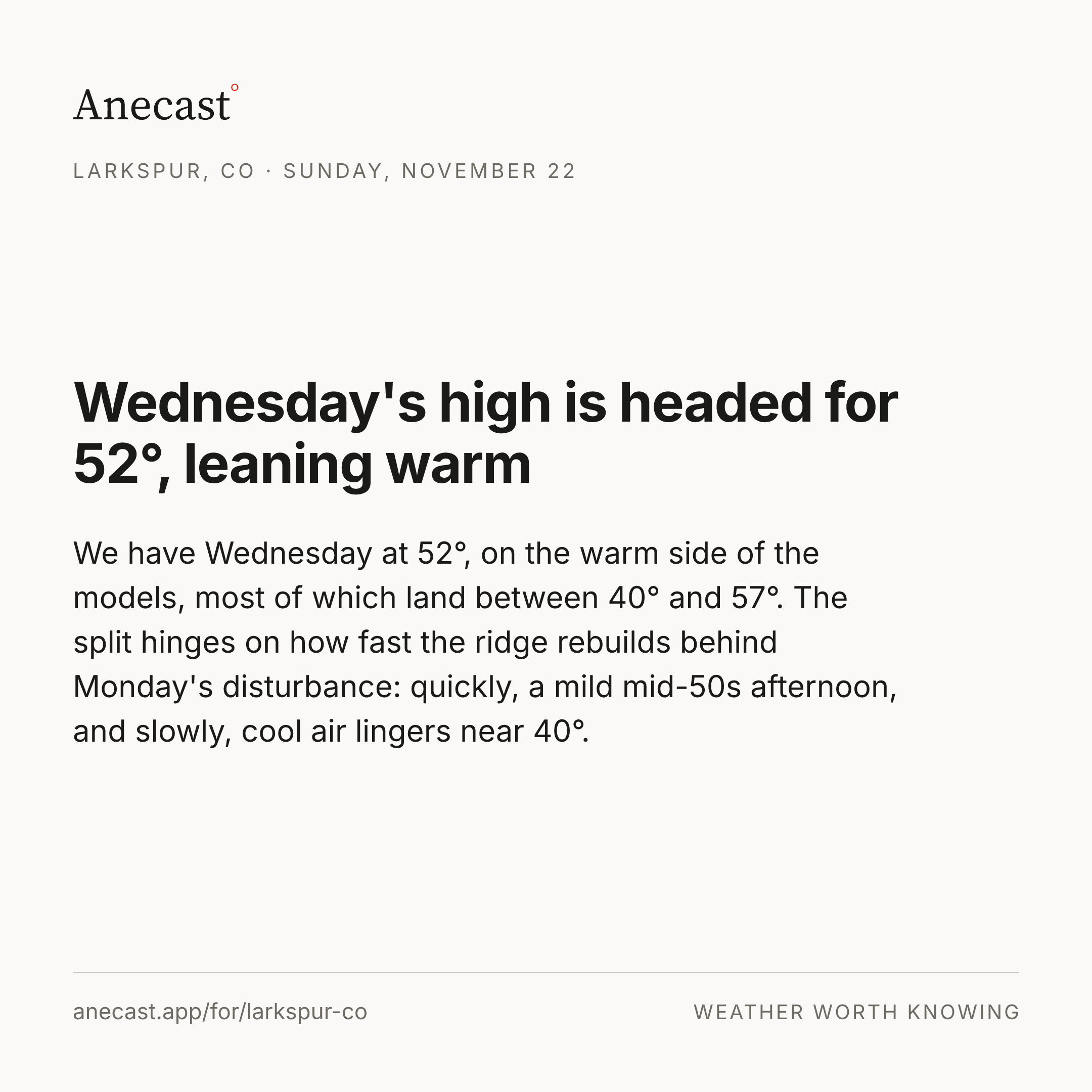
We've raised Thanksgiving's high from 47° to 51°
We've bumped Thanksgiving Day's high from 47° to 51° as the longer-range pattern trends drier and warmer late next week. The rain chance also slid from 19% to 7%.
Yesterday's receipt · Friday
Around Larkspur · Friday
Elbert Mountain - Monument Pass, 13.3 miles away and the station that grades Larkspur's forecast, read a high of 57°; the official gauge at City of Colorado Springs hit 62°, 5° hotter.
The stations
| Station | Miles | High | Usual gap | Rain (at least) |
|---|---|---|---|---|
| Elbert Mountain - Monument Pass · grades the forecast | 13.3 | 57° | — | — |
| Air Force Academy | 18.7 | 63° | — | — |
| Denver - Centennial Airport | 22.8 | 63° | — | — |
| City of Colorado Springs Municipal Airport · official gauge | 31.1 | 62° | — | — |
| Buckley Space Force Base | 34.1 | 65° | — | — |
Keeping score
‹How our forecasts did · this week›
How each day was scored
| Observed | Anecast | NWS | ||||
|---|---|---|---|---|---|---|
| forecast | miss | forecast | miss | |||
| Thu | high | 59° | ✓ 57° | −2° | 57° | −2° |
| rain | 0.0 in | ✓ 0.0 in | in range | 0% | % only | |
| Fri | high | 57° | ✓ 54° | −3° | 54° | −3° |
| rain | 0.0 in | ✓ 0.0 in | in range | 36% | % only | |
Recent days
November so far at the Colorado Springs airport, 31 miles south: 0.06 inches of rain, 0.20 below normal · since Jan 1 at the Colorado Springs airport, 31 miles south: 8.92 inches of rain, 6.65 below normal
Know when Larkspur's forecast changes
Missing your city?